


Mid-City Housing and Community Assessment
The assessment comprised three primary steps: community engagement, a housing survey, and the development of an interactive web mapping tool.Community Engagement
Community engagement was critical to the process of developing the Mid-City housing and community assessment and was used to inform the public about the project, obtain information on opportunities and challenges in the community, and involve the community in the planning process. The assessment included a wide range of community engagement strategies, including forming a steering committee (Niagara Falls Neighborhood Evaluation Committee), holding multiple open houses and webinars, and working with students at Niagara University.
The Niagara Falls Neighborhood Evaluation Committee, comprised of representatives from diverse groups and organizations committed to improving the standard of housing and quality of life in Mid-City, was responsible for guiding the overall direction of the Mid-City housing and community assessment as well as setting the guidelines for data collection.
Students enrolled in Niagara University’s computer science course, taught by steering committee member Professor Dr. Tong, were engaged in the project early on. This allowed them to explore the field of geospatial analysis and learn how to use GIS software for conducting housing and community assessments.
Niagara University students were engaged throughout the project in several ways, including:
- Members of the consultant team delivered a presentation to students about the application of GIS in their professions and the career opportunities available in the field.
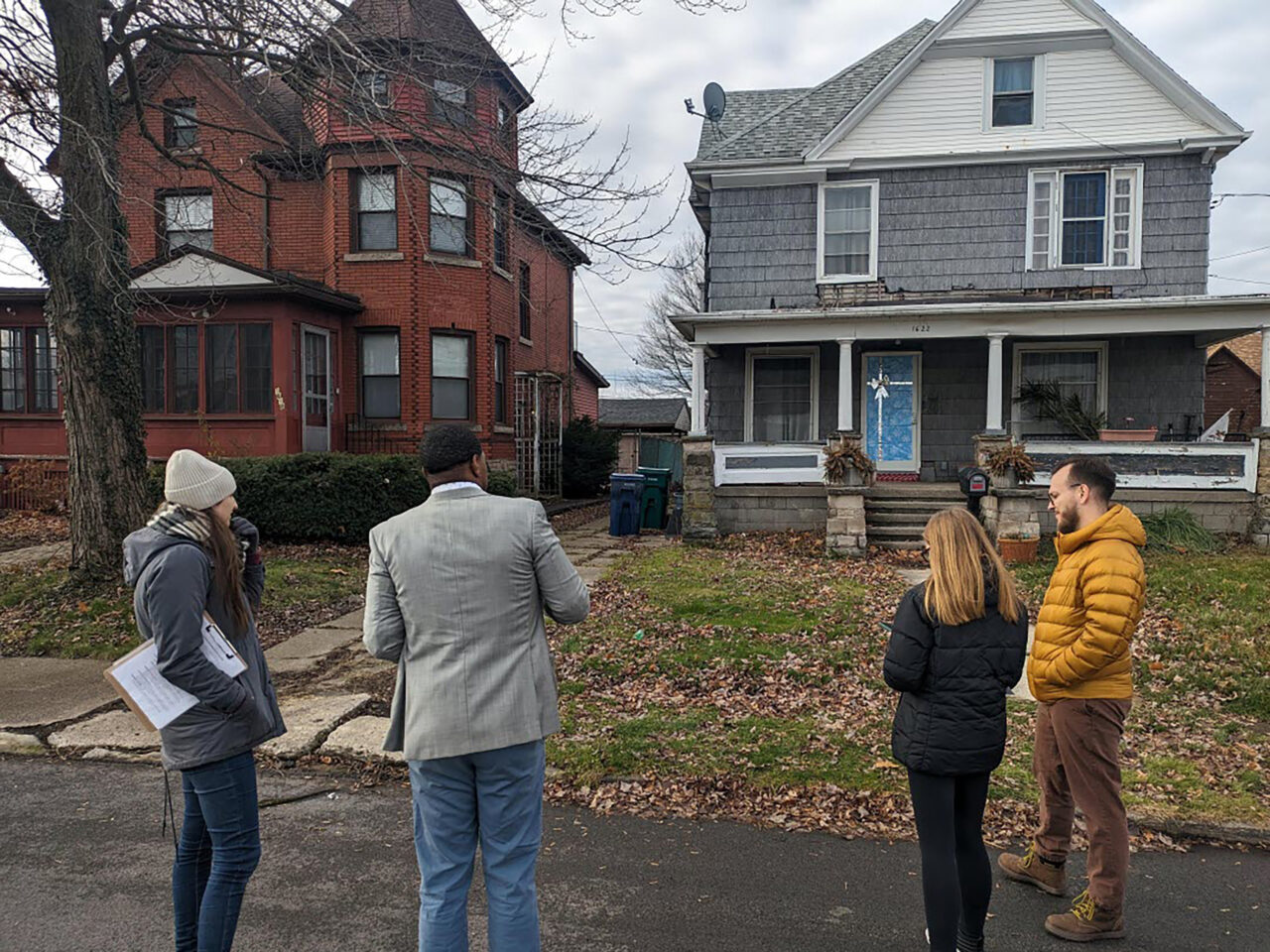
- Students were invited to observe and assist with field data collection during Phase II of the housing survey.
- Students were provided a dataset containing a significant portion of the GIS data collected during the process, enabling them to conduct their own research.
- Students in the computer science course will assist in periodically updating information on the webpage.
Housing Survey
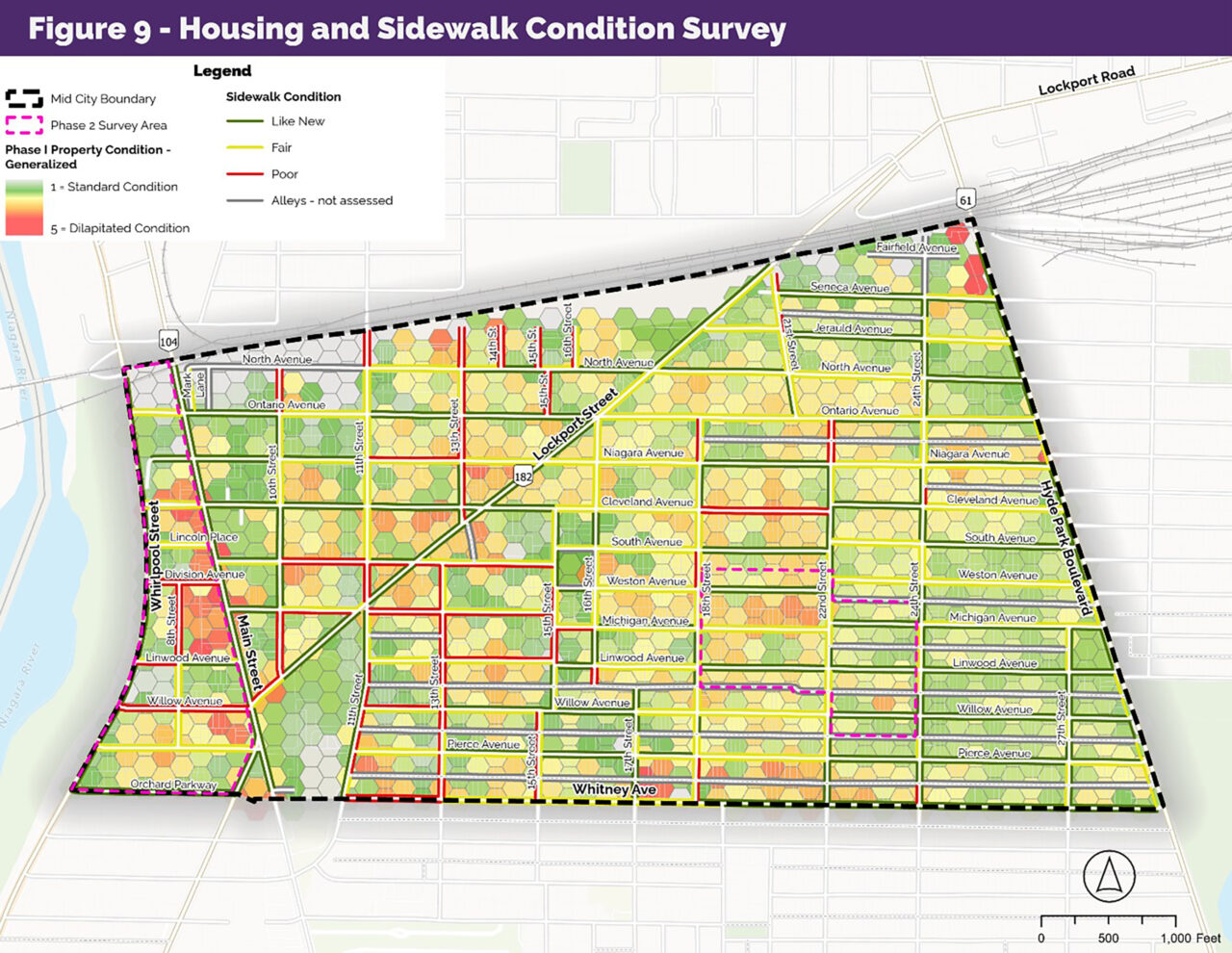
To develop a greater understanding of the current housing conditions in Mid-City, housing surveys were conducted to evaluate the housing stock and identify areas for future targeted investment. The housing survey had two components. Initially, a “windshield” survey assessed the general condition of all 3,320 parcels in Mid-City on a scale of 1 to 4. A rating of 4 indicated houses were in standard (good) condition, while a rating of 1 indicated houses were considered “dilapidated.”
Next, a detailed survey conducted an in-depth analysis of housing conditions within two target areas selected by the committee. These areas included 357 houses, which were evaluated based on the condition of the foundation, the façade and front porch, the roof, and the windows. Each category was rated on a scale of 1 to 5, which was then combined to provide an overall condition rating ranging from above-standard (excellent) to dilapidated (unlivable). Data was collected using mobile GIS tools and made available to the Niagara Falls Neighborhood Evaluation Committee via ArcGIS Online web mapping tools.

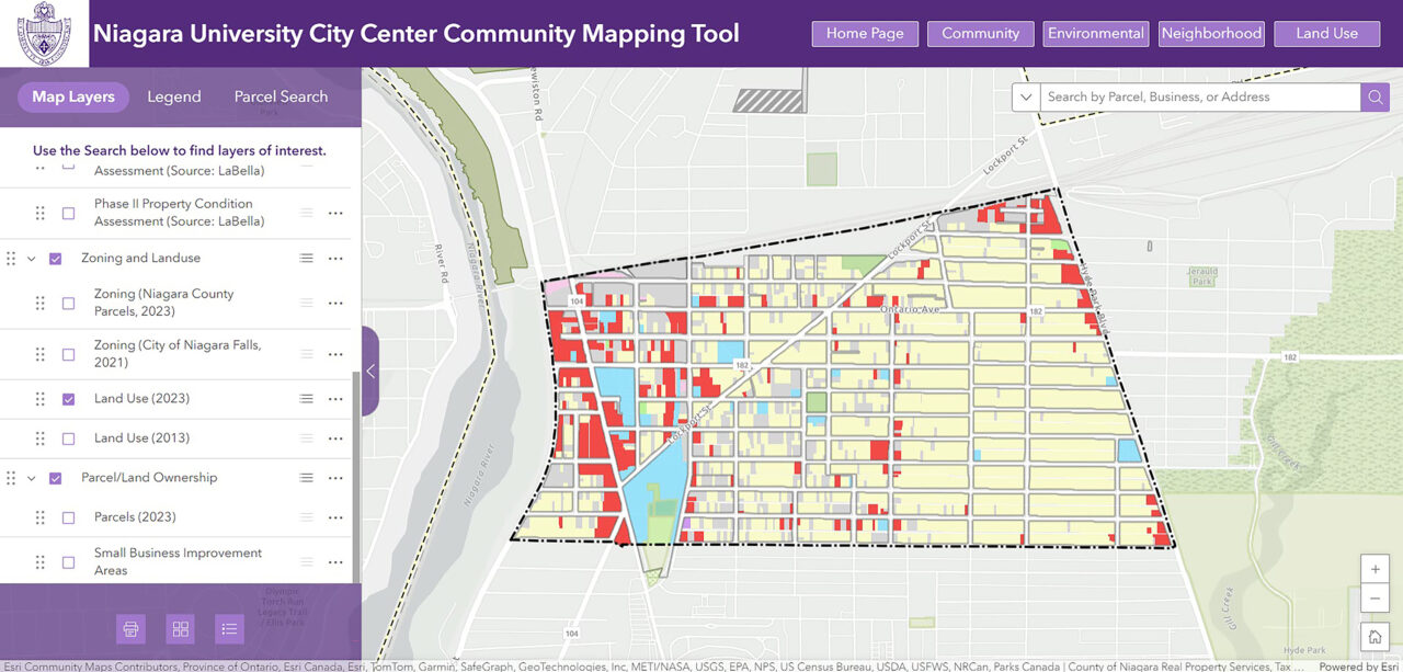
Interactive Web Mapping
The final product of the Mid-City housing and community assessment was the development of an interactive online web mapping tool. The tool serves as an easily accessible resource for the City of Niagara Falls and its partners, as well as the greater public. It offers information on demographics, land use and zoning, environmental features, housing characteristics and conditions, and a range of other factors that contribute to the overall quality of life for residents in Mid-City. Developed by utilizing ArcGIS Experience Builder and ArcGIS Hub tools, the online mapping tool will be instrumental in helping the city and its partners create a comprehensive housing strategy backed by actionable goals that are supported by real-life conditions.
Following the development of the interactive mapping tool, a webinar was hosted for interested agencies, organizations, and other partners invested in revitalizing the City of Niagara Falls, particularly the Mid-City neighborhood. During the webinar, attendees received an overview of the mapping tool, including the data collection methodology and potential applications for their work. Emphasis was placed on how the tool supports grant applications and the possibility of integrating additional valuable data sources in the future.
Sampling of Housing Conditions in Mid-City


Take a Quick Tour Through Niagara University’s Interactive Community Web Mapping Tool
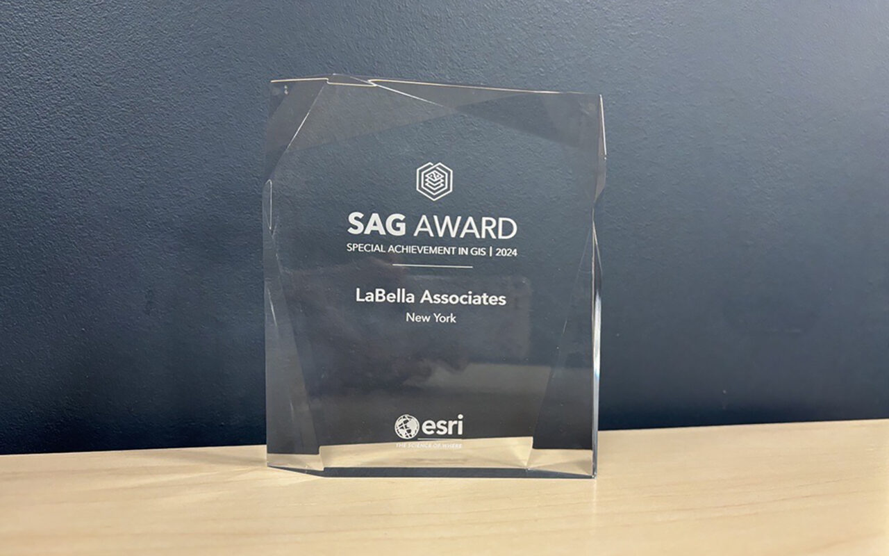
An Award-Winning Project
GIS-Supported Strategic Planning Project Receives Esri 2024 Special Achievement in GIS Award!
In July 2024, LaBella and Niagara University were honored to receive a 2024 Special Achievement in GIS Award from the Environmental Systems Research Institute (Esri) for the GIS-Supported Strategic Planning project in Niagara Falls. This award was one of 197 chosen from more than 100,000 Esri clients worldwide!
The Special Achievement in GIS awards are given to user sites worldwide to recognize exceptional work with GIS technology. Nominations come from vertical industry managers, U.S. regional offices, and international distributors, with finalists selected by Jack Dangermond, President and Founder of Esri (pictured at right with Rebecca Smith, GISP, Data Intelligence Lead at LaBella.)
Photo credit: Esri


An Award-Winning Project
Housing and Community Assessment Project Recognized for Outstanding Planning at WNY APA Annual Awards Event
Each year, the Western New York Section of the American Planning Association (APA) recognizes outstanding planning efforts across the Great Lakes region. At this year’s Annual Awards Event, held in May 2025, LaBella was honored to receive the 2025 Western New York APA Best Practice Silver Award.