Celebrating National Land Surveyors Week: Honoring the People, Projects, and Places
National Surveyors Week is an annual week-long celebration of the land surveying profession that takes place in March (the 16th–22nd this year). It is an opportunity to recognize the importance of land surveyors and the work they do, which serves as the foundation for many of our projects. To celebrate National Surveyors Week, we honor the people, projects, and places in stories and photographs below.
People: The Foundation and Future of Land Surveying
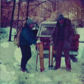
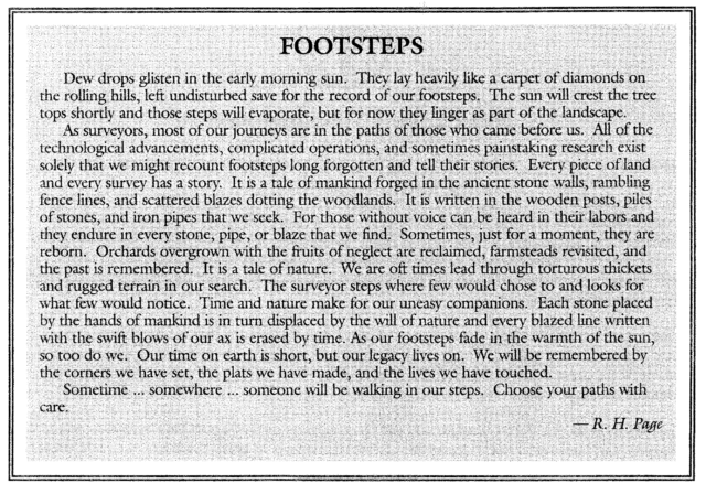
The outdoors, the details, the history, the technology—when LaBella’s Senior Project Surveyor Bruce Wells, PLS, joined the land surveying profession 54 years ago, little did he know how deeply he would come to appreciate these elements, along with this written piece “Footsteps” by R. H. Page (pictured below), which he shared with his staff annually for many years.
“During my 54-year career, I had my hands in about every aspect of land surveying. What I have always enjoyed about land surveying over these many years is the history. The history of how land was transferred, following the footsteps of the original land surveyor, the legal real property issues, the boundary determination, the intent of the parties, and the clients. What I miss most is being the one in the field interpreting the deeded calls and finding the changes of forest growth, stone walls, dead furrows, stone cairns, old fences hidden in trees or buried in the ground, tree blaze marks, old abandoned roads that have been overgrown in time, property markers of all shapes and materials, and the outdoors in all types of weather. To the next generation of land surveyors: Continue to follow the footsteps of the original surveyor!” – Bruce Wells, PLS, Senior Project Surveyor at LaBella Associates
Projects: What Fuels the Profession
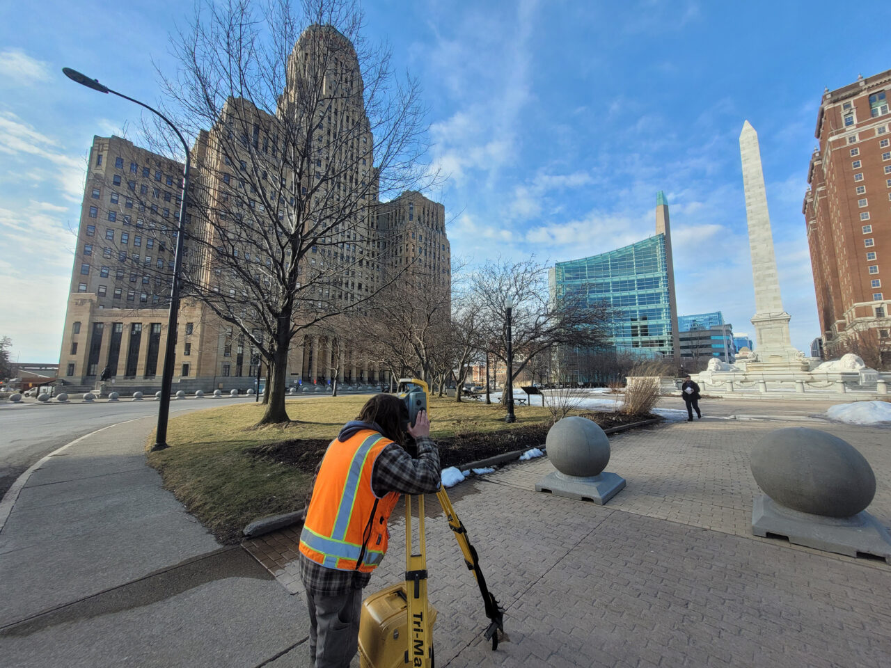
In the heart of Buffalo, New York, geothermal energy is being explored as a means to heat and cool the historic buildings of Niagara Square and its surroundings. Such an undertaking requires discovering and mapping over 200 years of infrastructure to identify where geothermal systems may be installed.
To support this, LaBella’s land surveyors created a property map from a boundary survey and utilized drone-mounted LiDAR technology to reproduce the layout of streets as they were originally designed in 1804, as well as the reconstruction performed during the area’s urban renewal project. The result? A comprehensive map that merges Buffalo’s 19th-century built environment with its 21st-century landscape—marking a first-of-its-kind land surveying endeavor for the city’s historic core.
More than an interesting challenge for LaBella’s land surveyors, this project is a step toward advancing green energy in Buffalo for the 21st century and beyond—underscoring the vital role of the land surveying profession.
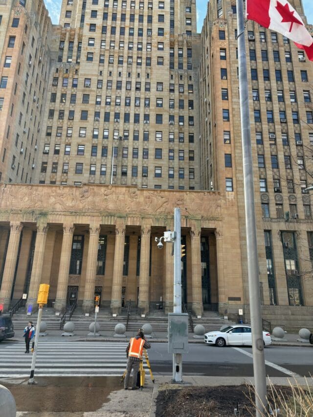
Pictured at right: LaBella’s Survey Party Chief Joseph Perez Gangi surveying in front of Buffalo’s City Hall.
Places: Inspiring the People
It’s amazing, the places land surveyors go—from forests, open fields, and trails to waterfronts, abandoned sites, and built environments.
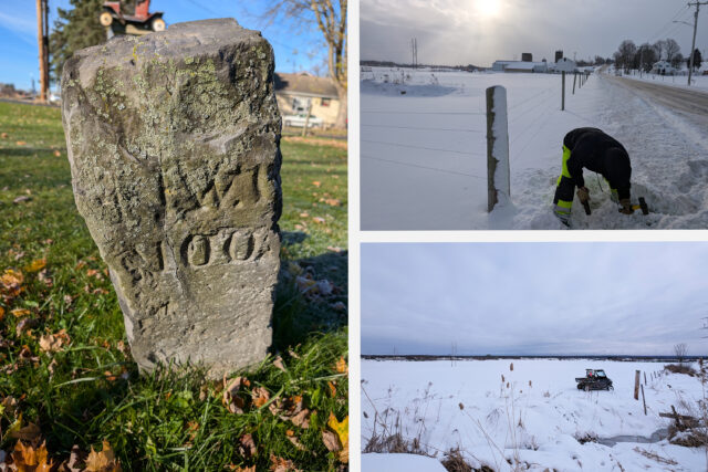
Pictured below, left: A land survey monument in Spencerport, New York, located during a right-of-way survey for a utility project. Despite its age, as evidenced by the erosion, this marker has stood the test of time.
Pictured below, right top and bottom: A topographic and boundary/right-of-way survey for a renewable energy project took this land surveyor to a snowy Lowville, New York.