In recent months, LaBella has enhanced its reality capture capabilities with the deployment of the NavVis VLX 3, a latest-generation, wearable laser scanning platform that utilizes Simultaneous Location and Mapping (SLAM) technology for rapid data capture at project sites. This innovative device significantly accelerates data collection, enabling LaBella to deliver accurate and efficient existing data for design projects, ensuring our documents start with precise information. When combined with our existing tripod-based units, we offer a comprehensive suite of scanning solutions that support a wide range of design projects, including Building Condition Surveys (BCS) in K-12 schools.
Device Overview
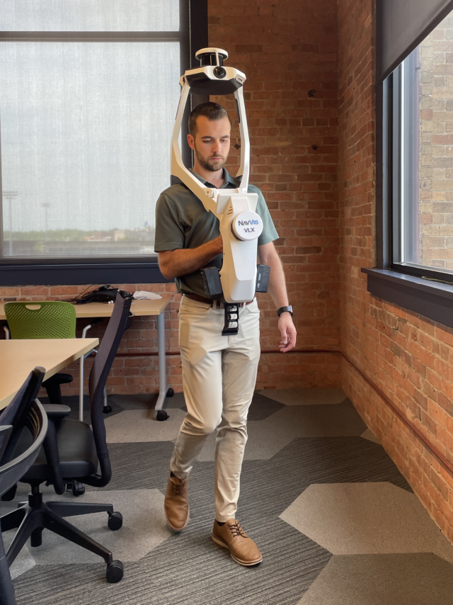
Featuring advanced SLAM technology, the NavVis VLX 3 is a state-of-the-art, wearable scanner designed for efficient, high-quality reality capture of large indoor and outdoor spaces. Unlike traditional tripod-based scanners, which must remain stationary during scanning, the NavVis VLX 3 is worn on the operator’s torso, enabling dynamic movement and the ability to capture large sections of a building at once.
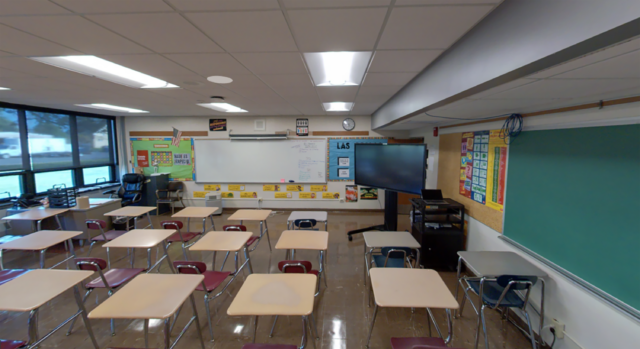
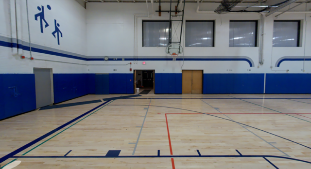
Equipped with two 32-layer LiDAR sensors and four high-resolution cameras, the device simultaneously captures three-dimensional (3D) measurements and 360-degree panoramic images. These images provide crucial context and are used to colorize the laser data in post-processing. The dual-sensor SLAM technology ensures accurate 3D scans, even in challenging environments with complex geometries or limited GPS signals, such as large school campuses, multi-level buildings, or narrow corridors. Additionally, a built-in touchscreen offers live scanning feedback, ensuring full coverage in real time.
This process significantly reduces capture times and minimizes site disruption compared to tripod-based scanning methods, making the NavVis XLV 3 a highly effective solution for large-scale projects like BCS in K-12 school districts.
Streamlined Data Management
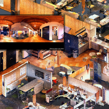
To complement the device’s scanning capabilities, LaBella utilizes NavVis IVION, a web-based portal for viewing and managing completed scans. Here, captured site data is uploaded and automatically processed, and after minimal final adjustments, the data is ready for use by design teams or clients. Additional steps can be taken to link the data into design software for further modeling and verification of existing conditions (note: photos cannot be viewed offline as of this time).
The web-based portal also displays all scanned sites on a geographical map, providing users with easy access to all available client locations. By utilizing the panoramic photos, users can navigate the scans in a Google Maps-like environment and interact with the laser data to measure distances and areas.
Time Savings and Efficiency
While tripod-based scanners remain unmatched in their capacity to capture intricate details in mechanical spaces or ornate architectural features on multi-story exterior façades, the NavVis VLX 3 stands out for its speed. It enables rapid data collection while still maintaining sufficient detail to verify existing measurements of major architectural features.
Since deploying the NavVis VLX 3 in July 2024, we have used the device across New York State, covering at least three school districts and multiple project sites. In just the first three months of use, our team captured nearly four million square feet of laser data, averaging approximately 1.2 million square feet per month. In contrast, scanning, processing, and exporting data from other district projects in the one-million-square-foot range can take several months using a traditional tripod-based unit.
While the tripod-based method is still considerably faster and more accurate than hand-measuring the same area, the NavVis VLX 3 significantly reduces project timelines, making it particularly well-suited for time-sensitive BCS in K-12 schools where minimizing disruptions to facility operations is essential.
Charting the Course Ahead
The NavVis VLX 3 represents a transformative leap in data collection for K-12 environments. Its combination of speed, precision, and advanced imaging capabilities enables quicker, more comprehensive visual and spatial assessments of school facilities, allowing districts to make timely and informed decisions regarding renovations and future planning.
As K-12 schools face growing demands for better facilities amid budget constraints, adopting tools like the NavVis VLX 3 is essential. By incorporating advanced scanning technologies into BCS and other K-12 projects, districts can improve their capacity to maintain and upgrade infrastructure, ultimately benefiting the educational environment for students and staff alike.
As technology continues to evolve, it will play a vital role in ensuring that educational facilities are safe, compliant, and well-maintained for the community. If you have questions or need assistance with your BCS, please contact us. Our team is ready to help your district leverage this innovative technology.


