Mechanicville Woodchuck Burrow Study
Evaluating Woodchuck Burrow Conditions With Ground Penetrating Radar
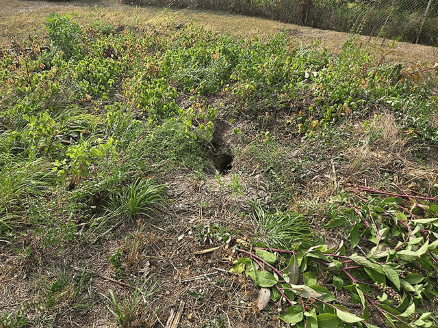
Over several years, extensive woodchuck activity had been observed at an existing dam embankment along the Hudson River near Mechanicville, New York. This raised concerns about the potential presence of hidden voids and underground burrow networks that could compromise the structure over time.
While numerous burrow openings had been noted throughout the embankment, the extent and depth of the subsurface burrow network remained unknown. Given the potential for underground voids to impact the long-term integrity and stability of the embankment, project stakeholders required a non-invasive method to investigate subsurface conditions and inform future remediation efforts.
GPR Investigation
To support these objectives, LaBella used ground-penetrating radar (GPR) technology to perform a detailed subsurface assessment of the embankment. Our team established GPS-controlled survey grids across three targeted areas and collected high-density GPR data to detect anomalies associated with burrows and subsurface voids.
Over the course of the investigation, our team completed 149 individual survey transects across the project site. Data was collected using uNext software and processed using Geolitix software to create detailed subsurface profiles and depth-specific maps. By analyzing the reflected radar signals, we were able to identify and delineate areas with characteristics consistent with burrow activity beneath the surface.
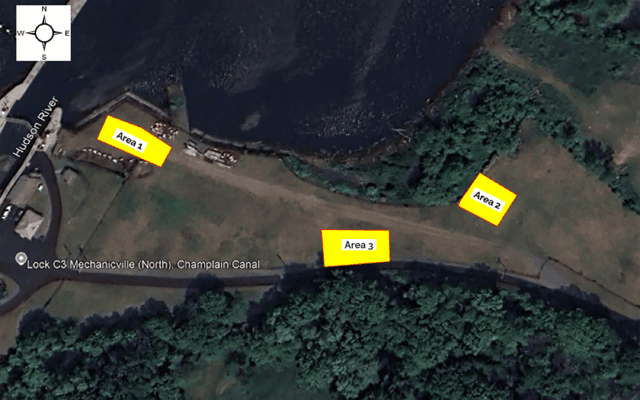
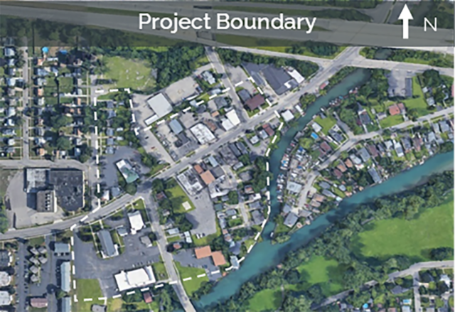
GPR Investigation Locations
Findings and Recommendations
The resulting dataset was used to develop topographic heat maps and related subsurface interpretation graphics, providing project stakeholders with a clearer understanding of the extent, location, and relative size of potential burrow networks within the embankment. The investigation identified multiple areas with subsurface anomalies consistent with potential woodchuck burrows and void spaces across all three survey areas. Some suspected voids were located near the edges of the scan limits, indicating that additional burrow activity may extend beyond the areas initially investigated.
Based on these findings, our team recommended removing and replacing affected embankment materials, rather than grouting the voids, as a practical and cost-effective remediation approach. We also recommended a full GPR scan of the entire berm area to better define the extent of burrow activity and support future remediation planning.
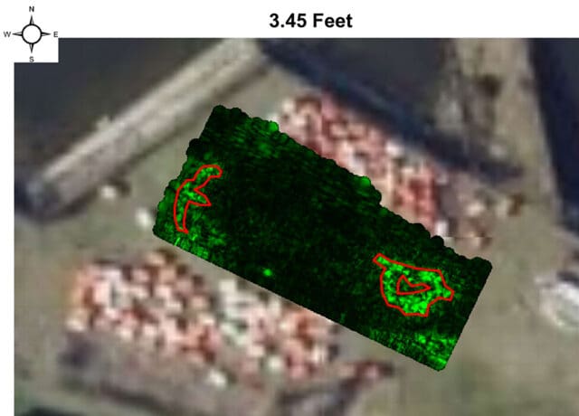
GPR Results for Area 1